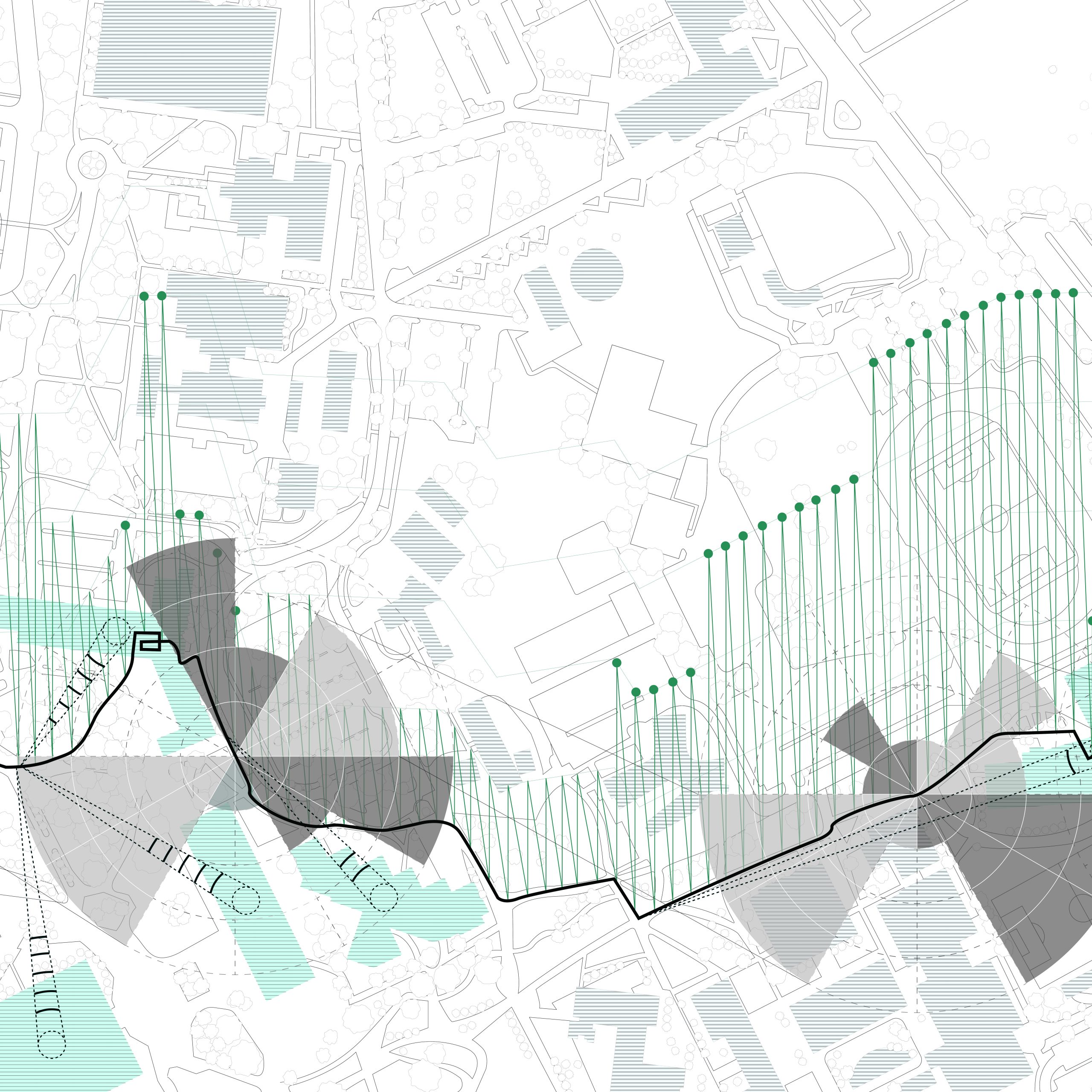
This is an experience map of the University of Utah. I started at 1300 E 200 S to the top of the Shoreline Ridge Apartments. I walked the same route multiple times, taking pictures, video, audio, and writing down notes. I was able to create an experience from my observations and own participation in the walk.


I drew every detail of the map in illustrator, making sure all the sidewalks and streets were parallel or perpendicular to each other. I then played with line thickness and color to make sure the map did not overpower the experience.

START TO END – The straight black line represents a direct line from starting point to the end point.
PATH TAKEN – The other black line is the path that was taken. I tried to follow the straight line as much as possible without cutting the paths. I could go inside buildings as well.
EXPERIENCES

The dotted dark green lines point to the location where I remembered the campus building which are signified by light blue coloring rather than grey. The lines inside represent how familiar I am with the building. The more lines the more familiar. I am more familiar with the west side of campus compared to the east side.

The grey scale radial measurement is wind. The dark grey represents the direction of artificial wind, and the light grey represents the direction of the natural wind. The natural wind is connected by black lines that reveal a pattern.

The green vertical line graph represents sound. The base of the graph changes according to the path taken. An artificial sound has a green closed circle at the top of each sound. If it does not have a green dot then it is a natural sound.

| Drawn in Illustrator
